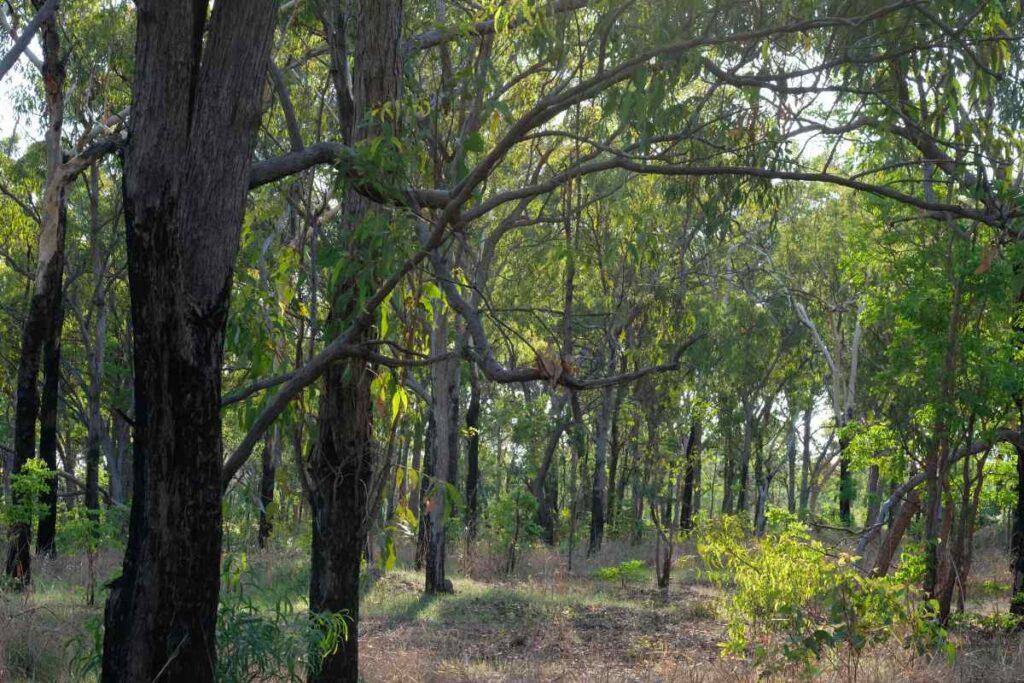
Darwin has one last remaining wildlife corridor and the large old-growth trees at Lee Point are a very important part of it.
In woodland habitat, large eucalypts account for almost all large tree hollows.
Large eucalypts are essential, they contain most of the tree hollows that 40% of mammals and 20% of birds rely on for shelter and breeding. Large eucalypts or large old growth trees (LOGT) have been are defined here as large eucalypts >35cm DBH, without dead trees or other tree species. LOGTs are believed to be generally over a century old.
By 2040, it is expected that Darwin-Palmerston will have lost 90% of its large old growth trees (from 40,000 to 4,000) increasing the importance of the Darwin Wildlife Corridor (~1200 LOGT).
In 2020, Lee Point contained about half the large old-growth trees within Darwin’s last wildlife corridor – 27km of connected habitat linking a national park and three conservation areas to the Darwin rural area.
The number of LOGT at Lee Point has been declining since 1944 due to land clearing. If the current defence housing project continues, half the LOGT (2020) at Lee Point will disappear, or about one quarter of LOGT in the Darwin Wildlife Corridor.
Protecting the large old-growth trees at Lee Point is about protecting Darwin’s last wildlife corridor, Darwin’s biodiversity and ultimately the quality of life of future generations.
LOGT numbers below were interpolated from Friends of Lee Point 2023 tree survey using aerial photographs and local knowledge.
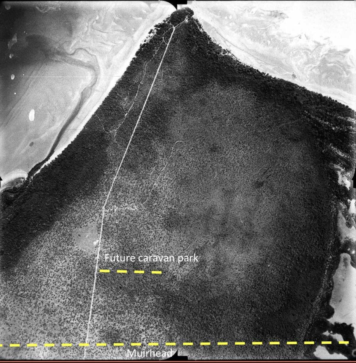
Fig 1. 1944 (over 1000 trees) – Lee Point has nearly all of its LOGT.
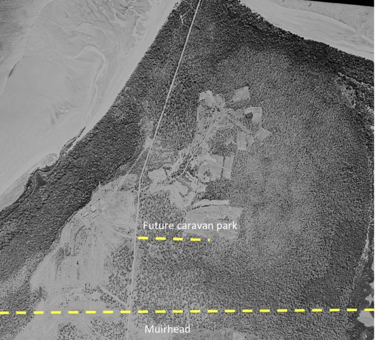
Fig 2. 1963 (~870 trees) – Land clearing of 2CRU by defence started 1959, sand and gravel mining probably happened in the 50’s and 60’s.
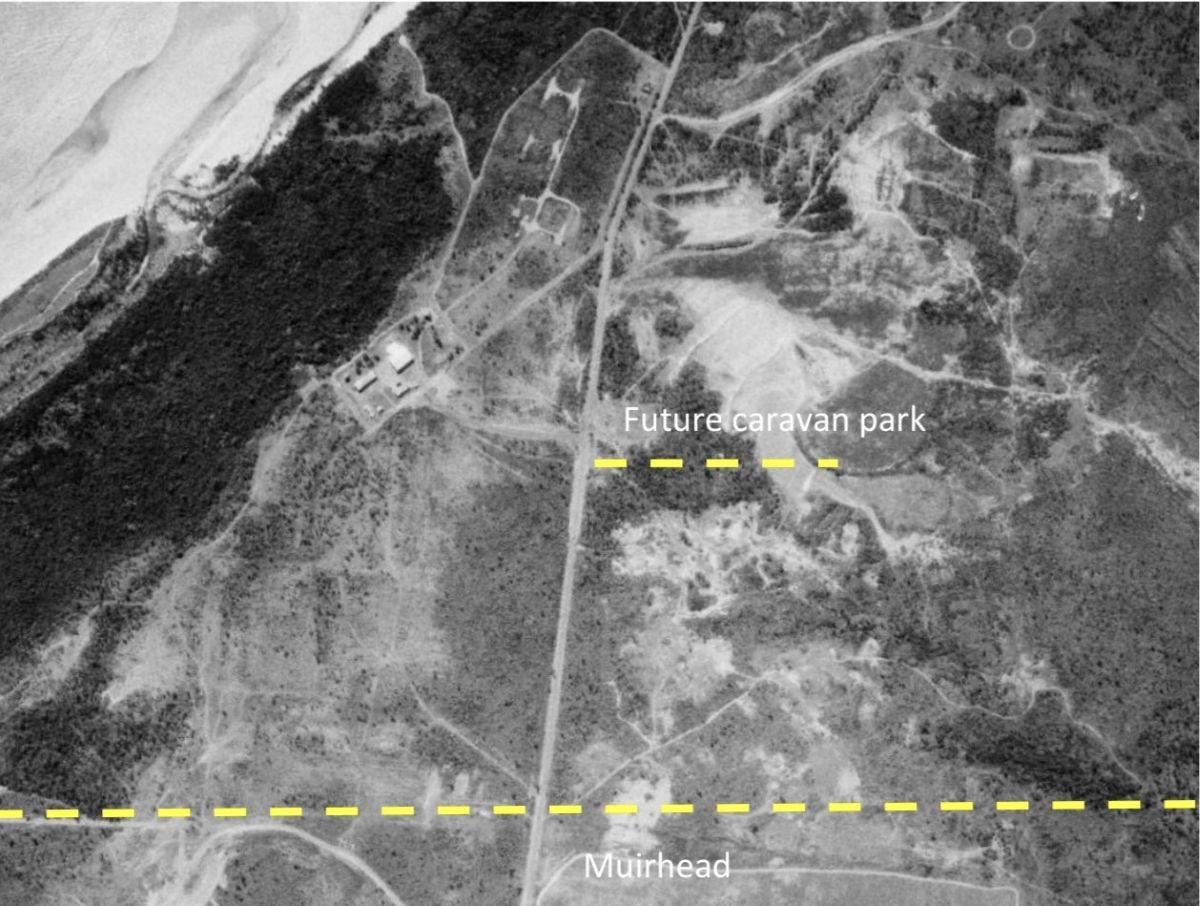
Fig 3. 1979 (~770 trees) – Land clearing of Muirhead North and Resort/golf course for mining (sand and gravel) during 1963-79.
The vast majority of LOGT survived the 1974 Cyclone Tracy despite being stripped of branches and leaves. The impact of Tracy can be seen here.
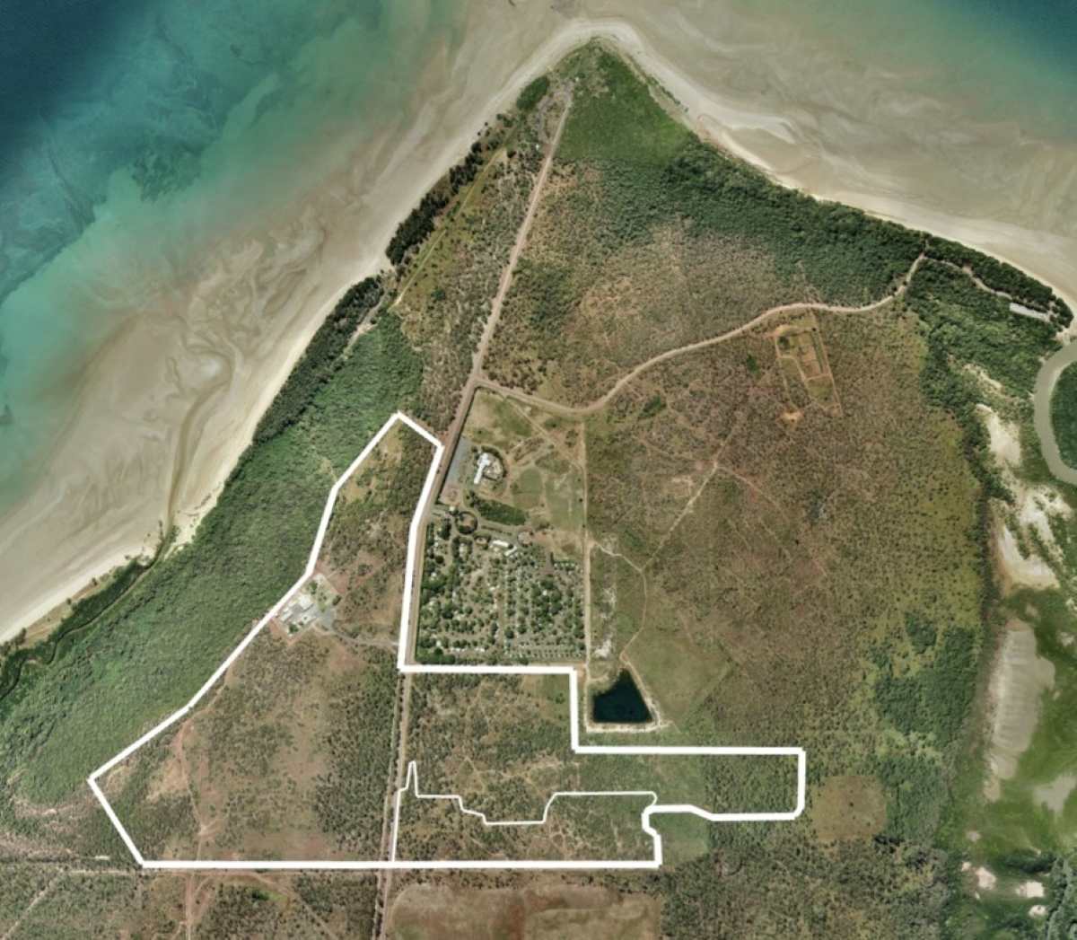
Fig 4. 2006 (~740 trees) – Land clearing for resort, dam built in early 2000’s. White outline is the clearing boundary for the future DHA housing project.
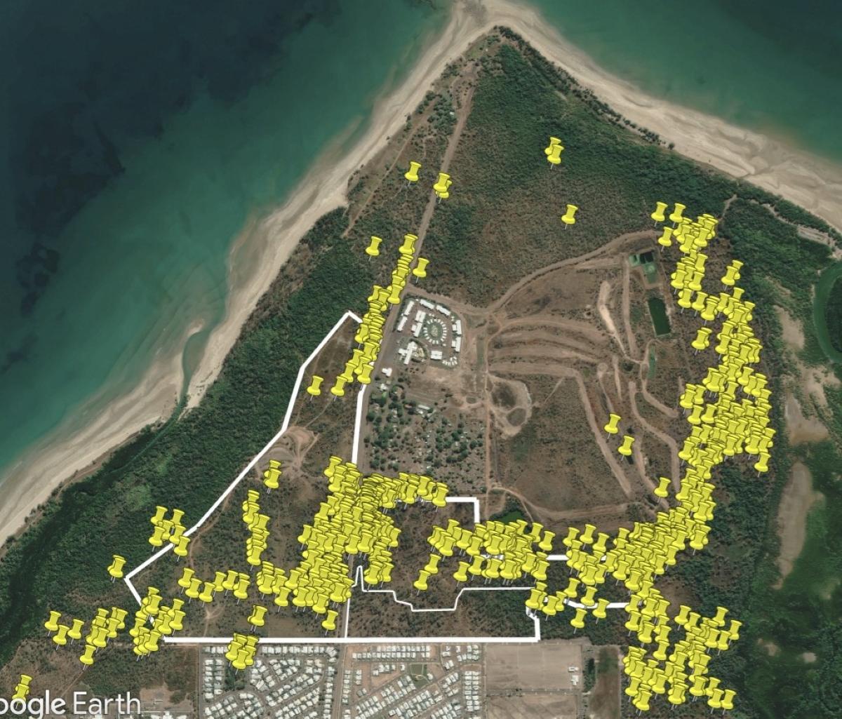
Fig 5. 2020 (~720 trees) – Land clearing for golf course fairways completed by 2009.
LOGT from the 2023 survey are shown as yellow pins. The ~720 tree number is based on the 2023 survey plus a LOGT estimate from areas not surveyed; Stage 1 (cleared in 2021) and some parts of northern Lee Point.
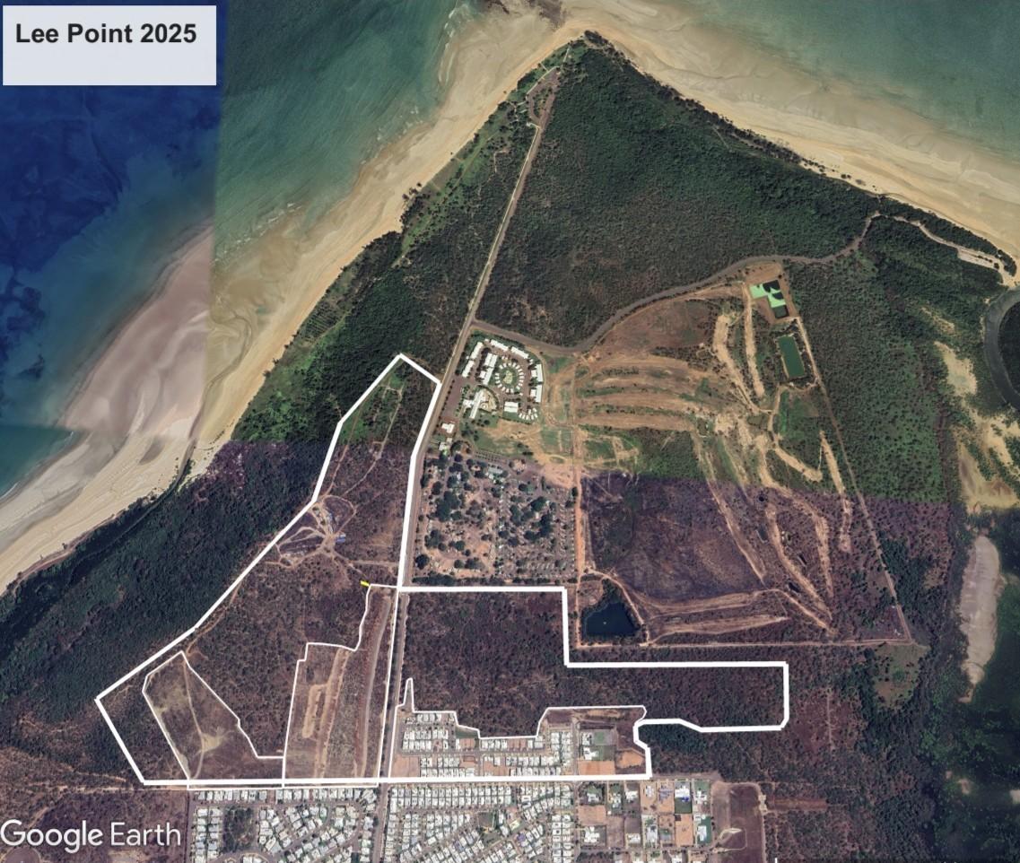
Fig 6. 2025 (~630 trees) – Land clearing of DHA Stages 1, 2 & 3 during 2020 to 2025.
Gamba Grass fires produced some tree losses (number unknown).
Assessment of areas
Based on above photos, 2023 tree survey (refer 2020 photo) and local knowledge.
The poorest sites for LOGT were:
- Golf course area – parts are poorly drained
- Northern Lee Point – parts are poorly drained and have shallow soil
The best sites for LOGT (has highest density of yellow pins) included east and west of Lee Point Road. Deep loam soils were a feature of these sites.
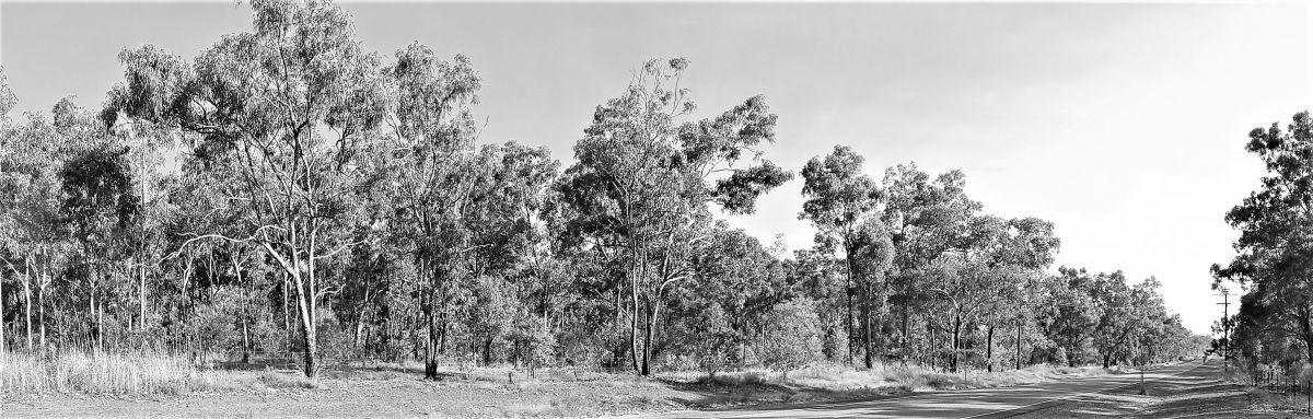
Fig 7. Old-growth trees on Lee Point Road looking north – April 2020
A 2ha patch on the east of Lee Point Road contained ~60 old-growth trees (30 trees per ha) – the highest density site recorded in the tree survey.
Note: The tree survey measured and recorded approx 2400 old-growth trees in 900 ha across Darwin.
2CRU habitat assessment table
This assessment uses large old-growth trees (LOGT) to categorise and assess habitat for large hollows along with local knowledge. Only eucalypts were counted as LOGT.
LOGT numbers have been much higher in the past. An indicative upper limit for LOGT is given below.
Numbers in the tables are prior to clearing works in 2CRU.
Table 1. 2CRU (west of Lee Point Road) – Lot 4873
|
|
2CRULot 4873 |
2CRU Offset |
Total offset/2CRU Area % |
Total Area ha |
78 ha |
22 ha |
27% |
Eucalyptus woodland ha |
50 |
8 |
16% |
Monsoon Rainforest ha |
18 |
14 |
100% |
Poor habitat ha |
10 |
0 |
0% |
|
|
|
|
|
LOGT number |
152 No. |
20 No |
13% |
Bloodwood |
49 |
6 |
12% |
E. tetrodonta |
72 |
14 |
19% |
E. miniata |
31 |
0 |
0% |
|
|
|
|
|
Potential LOGT No. |
~250 No. |
20 No |
|
Categories
-
Eucalyptus woodland – contains mainly tetrodonta or E. miniata LOGT
-
Rainforest – closed in canopy, no eucalypts
-
Poor habitat – no LOGT, few trees.
-
LOGT potential is based on 1944 aerial photography.
Notes
-
2CRU offset is part of 2CRU and the offset contains mainly monsoon rainforest.
-
Poor habitat areas – cleared woodland areas regenerating slowly, topsoil lost through erosion.
-
A medium-high density of LOGT in an area indicates the potential for rich mid-story vegetation.
-
LOGT potential – 1944 woodland area was ~64ha. Substantial clearing happened in the 60’s and a significant portion of the woodland area (54 ha) is now regrowth. Today, the diameter of the regrowth eucalypt trees from the 60’s are approaching 15-20cm.
Summary – most woodland and large eucalypts in 2CRU will be lost from the DHA housing project.
Future of Lee Point old-growth trees and wildlife
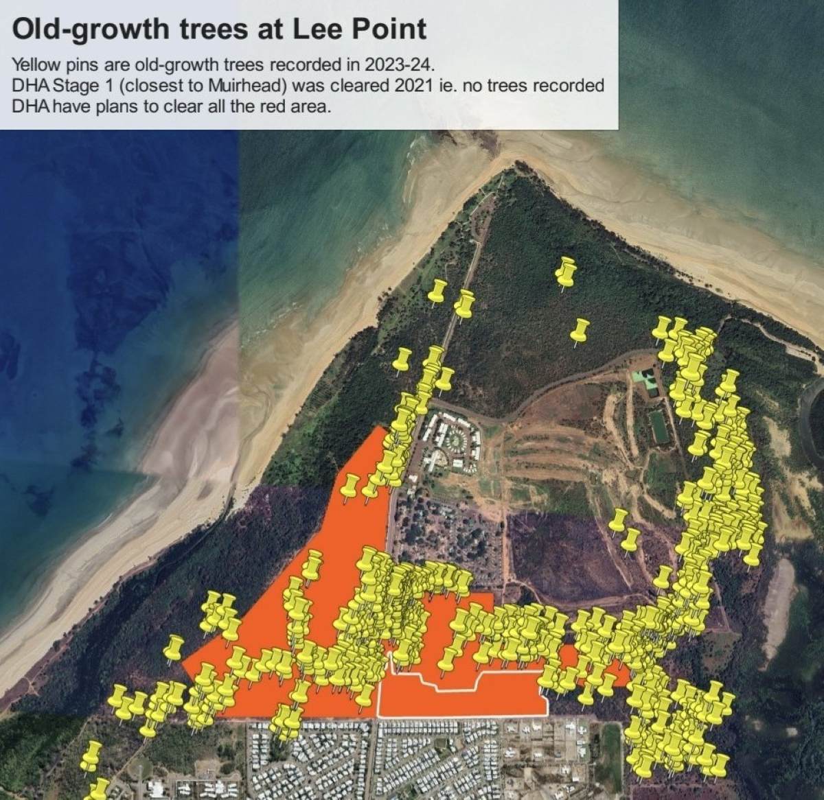
Fig 8. 2025 map with 2023-24 tree survey.
In 2020, the orange section (DHA housing project without 2CRU offset) contained half the ~720 LOGT on the Lee Point peninsula.
In 2025, due to clearing in the orange area LOGT numbers had reduced to ~630.
2030 (~290 or ~630 LOGT)
The lower number (290) is based on the the orange section (DHA housing project) being cleared and no change to management of Gamba Grass or fires. Old-growth trees are particularly vulnerable to fire.
Gamba Grass is now common in all woodland areas at Lee Point except Casuarina Coastal Reserve.
The upper tree number (630) represents no further clearing and good management of soil erosion and Gamba Grass/fires.
2050 (less than 100 or ~630 LOGT)
The lower number (less than 100) is based on the the orange section being cleared and no change to the management of Gamba Grass or fires. The long term impact from repeated Gamba Grass fires could be devastating.
The upper LOGT number (630) represents no further clearing and good management of soil erosion and Gamba Grass/fires. Even with good management, the LOGT number is not expected to change significantly by 2050 due to their slow growth rate.
Impact
Charles Darwin University believes that Lee Point is vital habitat for the endangered Black-footed Tree-rat species.
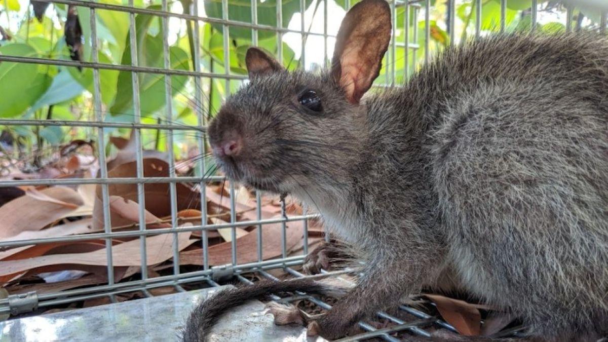
Fig 9. Black-footed tree-rats are among the species scientists found at Lee Point. (Supplied: Sam Banks) – source ABC
Both the endangered Black-footed Tree-rat (BFTR) and Gouldian Finch have been recorded in the orange section, refer Fig 8. These species rely heavily on LOGT (tree hollows) for breeding and shelter.
Clearing the “orange” zone would critically fragment vital habitat, further jeopardizing the survival of the endangered Black-footed Tree Rat and Gouldian Finch. To avoid this impact, the Lee Point housing project must be relocated.
Potential alternative sites, along the Stuart Highway, are outlined in the document, Relocating and rescoping the Lee Point defence housing project.
Recommendations
Recommendations to protect Lee Point’s large old-growth trees and endangered wildlife (Black-footed Tree-rat and Gouldian Finch) are:
- Relocate the DHA housing project to the Stuart Highway
- Manage Gamba Grass and fire risks near large old-growth tree sites, and
- Implement these protections as soon as possible.
For further information, refer:
Historical aerial photos – website
Lee Point – protecting critical habitat and Darwins last wildlife corridor report